Digital Elevation Models
The gdaldem utility can be used to analyze and visualize DEMs.
Let’s analyze our clipped DEM
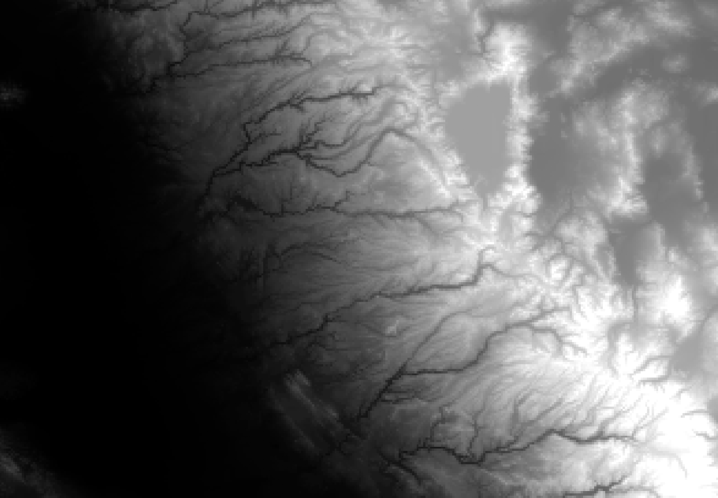
Hillshade
Generate a hillshade (shaded relief map)
$ gdaldem hillshade -of png gt30w140n40_clipped.dem hillshade.png
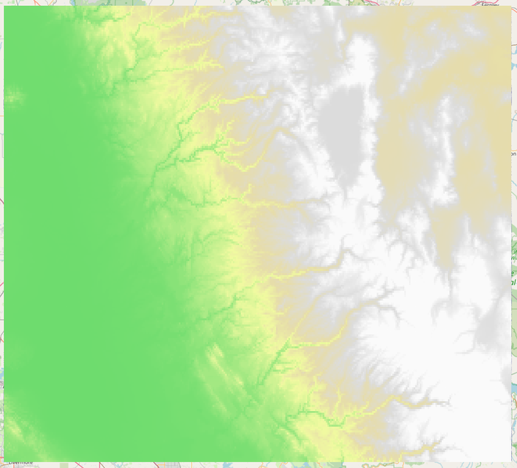
Color Relief
Generate a color relief map with values are computed from the elevation and a color configuration file (colorramp.txt)
$ gdaldem color-relief gt30w140n40_clipped.dem colorramp.txt color_relief.tif
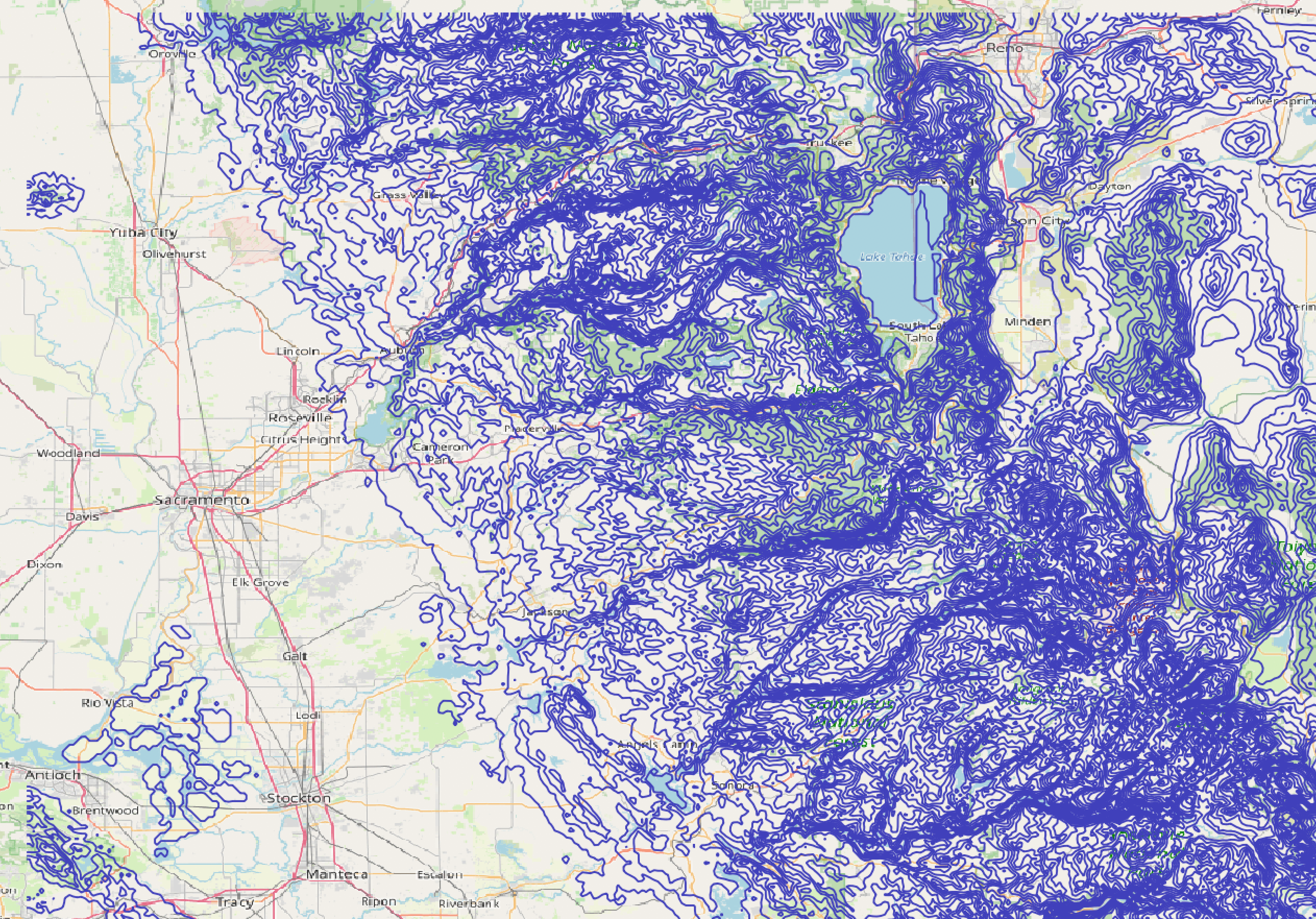
Contour Lines
Build vector contour lines from a raster elevation model. Use the -a flag to set the elevation attribute and -i flag to specify elevation intervals.
$ gdal_contour -a elev -i 100 gt30w140n40_clipped.dem contours_100m.shp